

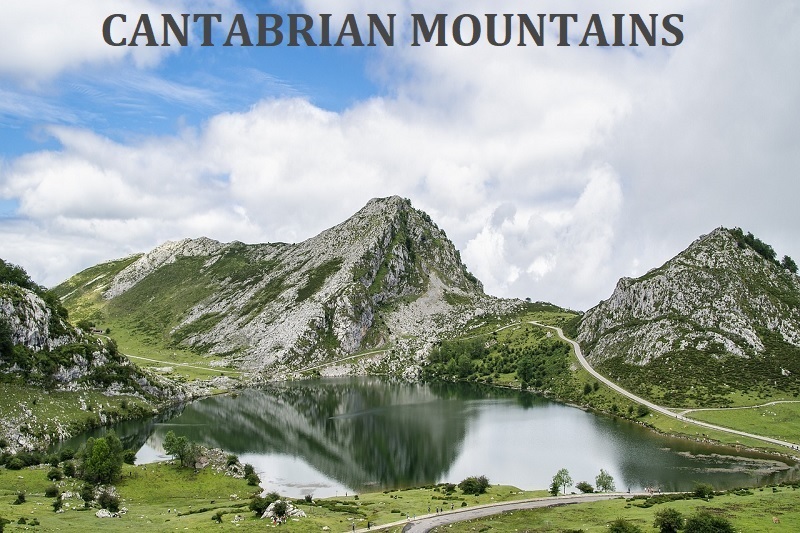
CANTABRIAN MOUNTAINS / Cordillera Cantábrica
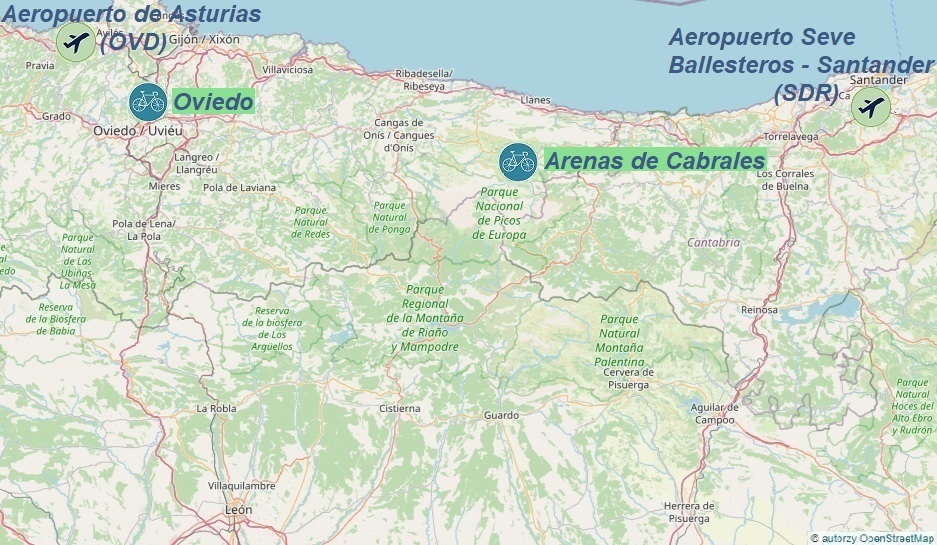
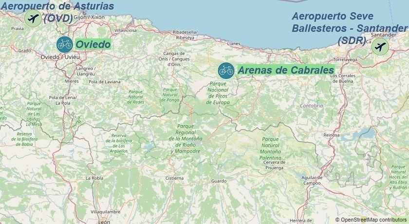

Oviedo: Alto de l'Angliru, Alto de La Cobertoria...
Arenas de Cabrales: Lagos de Covadonga, Alto de Sotres...
OVIEDO
The quickest way to get to Oviedo is by flying to Asturias Airport (OVD);
information on finding a cost-effective flight connected with rail and bus transport can be found in the transport section;
One of the many cost-effective ways to get to Oviedo is as follows:
upon arrival at the Asturias Airport, head to the bus stop, and take the bus to the center of Oviedo, which takes approximately 45 minutes; buses depart every hour, and the ticket costs 9€; the schedule can be found on the carrier's website;
Upon arrival in Oviedo, take public transport to the pre-booked accommodation. Good places to search for accommodation are trusted services like airbnb.com and booking.com;
Depending on the arrival time, it is worth taking advantage of the wide range of gastronomic offerings before going to the bike rental; the locations of gastronomic points can be found on the mapy.cz website;
If you're not hungry, don't waste any time and head straight to the most important part of the plan...
Carma Bike road bike rental is located at: C/ Angel Muñiz Toca 12 Bajo, 33006 Oviedo; it's worth reserving a bike well in advance to ensure bike rental upon arrival; current bike rental prices can be found on the above rental website;
All proposed cycling routes (GPX tracks) from Oviedo start at the Oviedo train station or after arriving by train at the Ujo or Pola de Lena stations.
If you're driving to Oviedo, you'll need to find a secure parking spot; paid and free parking locations are shown on the mapy.cz website;
For more information about Oviedo and its surroundings, visit the official city website.
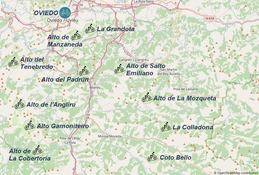
Hills accessible from Oviedo:
1. 72km - Alto de l'Angliru: 1570m
2. 88km - Alto del Padrún: 385m
- Alto de Salto Emiliano: 525m
- Alto de La Mozqueta: 848m
- Alto de Manzaneda: 389m
3. 72km - Alto Gamoniteiro: 1767m
- Alto de La Cobertoria: 1173m
- Alto del Tenebredo: 509m
4. 94km - Coto Bello: 1198m
- La Colladona: 850m


ARENAS DE CABRALES
To get to Arenas de Cabrales quickly, the easiest way is by flying into Asturias Airport (OVD); information on finding a convenient flight with connections to rail and bus transport can be found under the transport section;
After arriving at Asturias Airport, head to the bus stop where Alsa buses depart for the center of Oviedo every hour. The ticket costs 9€, the journey takes 45 minutes, and the schedule can be found on the carrier's website: select "Aeropuerto Asturias" to "Oviedo / Uviéu".
Transfer to a regional train to Arriondas, where the schedule can be found here - the ticket costs around 5€ and the journey takes 1 hour and 36 minutes. We can also reach Arriondas by Alsa bus.
At Arriondas, transfer to an Alsa bus that runs 3 times a day to Arenes de Cabrales;
From the bus stop, we can reach our pre-booked accommodation by taxi or on foot. Good places to look for accommodation are trusted websites like airbnb.com and booking.com;
Depending on the arrival time, it's worth taking advantage of the wide range of dining options before heading to the bike rental shop. In that case, the locations of dining spots can be found on the mapy.cz website;
If we're not hungry, we don't waste time and head straight to the most important point of our plan...
The road bike rental shop Bike Picos S-Cape Travel is located at: S-Cape Travel 33554 ,Edificio Sovega, bajo n° 2, Ctra. General, s/n, 33555 Las Arenas, Asturias; It's worth booking a bike well in advance to ensure availability upon arrival. The current rental prices can be found on the rental shop's website.
All proposed bike routes (gpx tracks) from the town of Arenas de Cabrales start at the Via Cida parking lot.
If we've arrived in Arenas de Cabrales by car, we need to find a safe parking spot. Paid and free parking areas can be found on the mapy.cz website;
More information about the town of Arenas de Cabrales and its surroundings can be found on the asturias.com website;
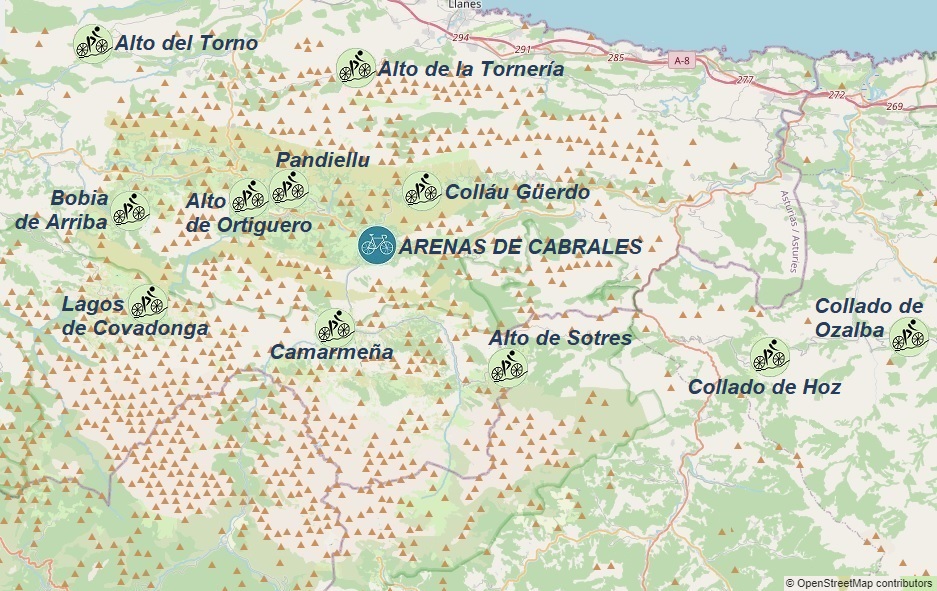
Hills accessible from Arenas de Cabrales:
1. 61km - Alto de Sotres: 1317m
- Camarmeña: 509m
2. 89km - Alto de Ortiguero: 1852m
- Lagos de Covadonga: 1572m
3. 91km - Alto de Ortiguero: 1884m
- Alto de la Tornería: 1572m
- Alto del Torno: 1572m
- Pandiellu: 522m
4. 115km - Colláu Güerdo: 1884m
- Collado de Hoz: 1572m
- Collado de Ozalba: 1572m


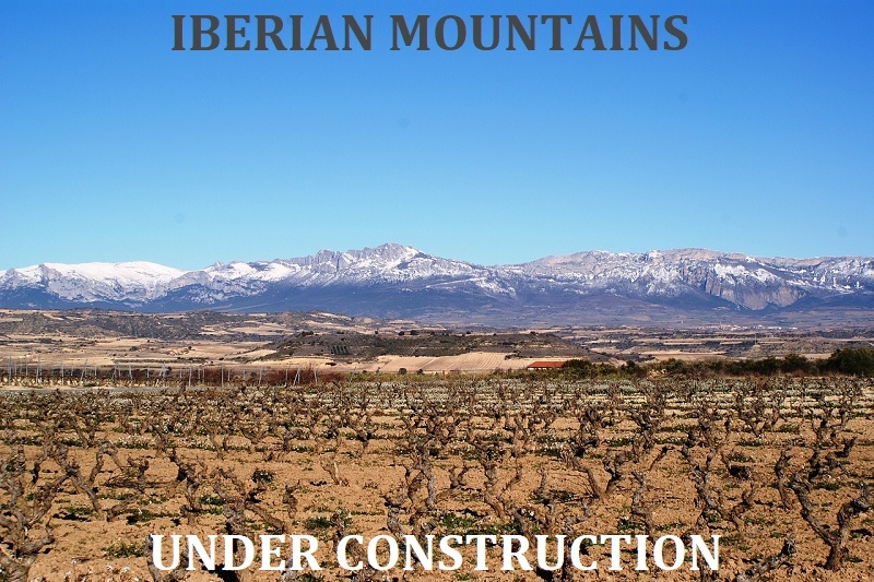
IBERIAN MOUNTAINS / Sistema Ibérico
UNDER CONSTRUCTION
LARDERO
To get to Lardero the fastest way possible, we can fly to either Aeropuerto de Logroño-Agoncillo (RJL) or Aeropuerto de Vitoria-Gasteiz Gasteizko Aireportua (VIT); information on finding a convenient flight connected with railway and bus transport can be found under the transport section - the website with Spanish airports is still under construction;
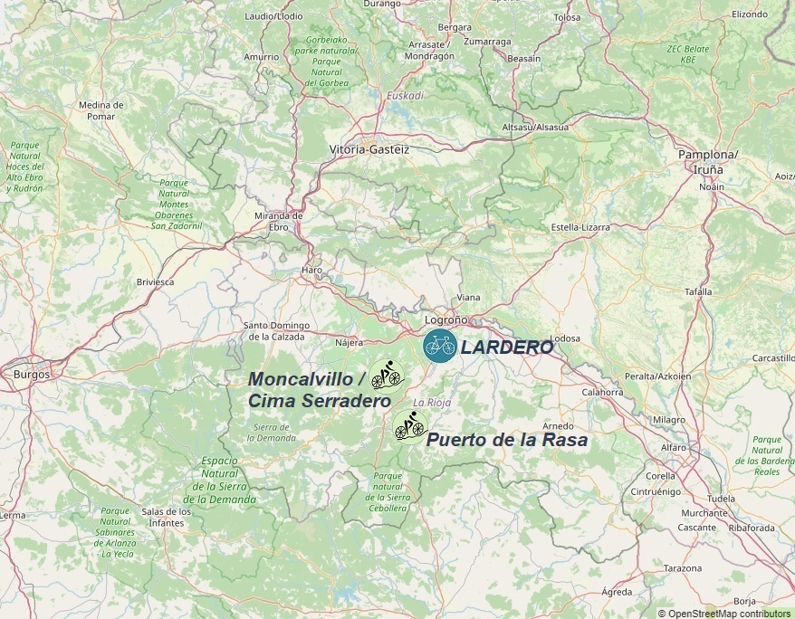
Hills accessible from Lardero:
1. 48km - Moncalvillo / Cima Serradero: 1491m
2. 92km - Puerto de la Rasa: 1391m
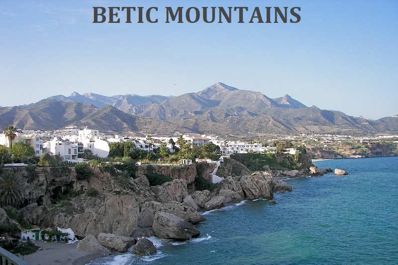
BETIC MOUNTAINS / Cordilleras Béticas
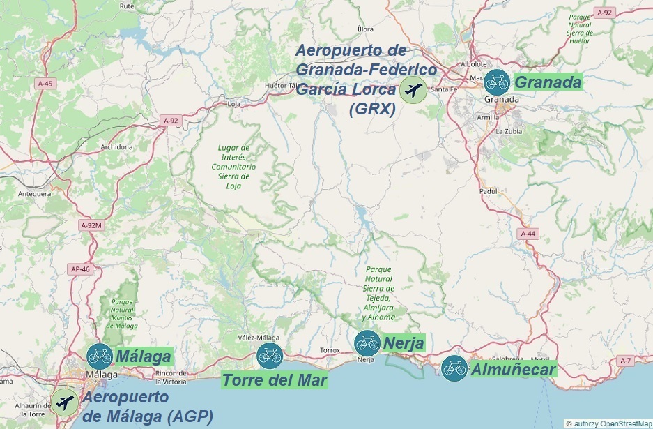

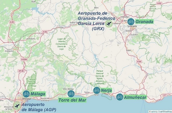
Almuñecar: Carretera de la Cabra, Peña Escrita...
Nerja: La Venta de Frigiliana, Cómpeta...
Torre del Mar: Puerto del Sol, Alto de Corumbela...
Málaga: Puerto del León, Cerro del Moro...
Granada: Alto de la Sierra Nevada, Pico Veleta...
ALMUÑECAR
To reach the town of Almuñecar, the fastest way is to fly to Málaga-Costa del Sol Airport (AGP); information on arrivals at other airports and how to find a favorable flight combined with rail and bus transport can be found in the transport section;
One of the many options for getting to Almuñecar is:
After arriving at Málaga-Costa del Sol Airport, we head to the C1 train station, from where trains to the center of Malaga depart every few minutes; we get off at Málaga María Zambrano station and walk to the bus station - Estación de Autobuses, which is located nearby;
at Estación de Autobuses, we transfer to the Alsa bus, which runs to Almuñecar every approximately 90 minutes; the journey takes from 1 hour 15 minutes to 2 hours and the ticket costs around €8; the timetable with the possibility of downloading the application can be found on the movelia.es website;
Upon arrival in Almuñecar, we can either walk or take a taxi to the previously booked accommodation. Good places to search for accommodation are trusted websites such as airbnb.com and booking.com;
If we want to take advantage of the gastronomic offer, we can find the locations of gastronomic points on the mapy.cz website;
If we are not hungry, we don't waste time and head to the main point of the program...
Cycle Almuñecar road bike rental delivers bicycles to the specified address in the towns of Almuñecar, La Herradura, Salobrena, and the surrounding area.
It is worth reserving a bike well in advance to ensure that you have a bike available upon arrival; current bike rental prices and the range of free bike delivery can be found on the rental company's website.
All proposed cycling routes (GPX tracks) from the town of Almuñecar start at Paseo de Blas Infante.
If we have arrived in Almuñecar by car, we must find a safe parking spot. Paid and free parking lots are shown on the mapy.cz website;
More information about the town and its surroundings can be found on the official city website;
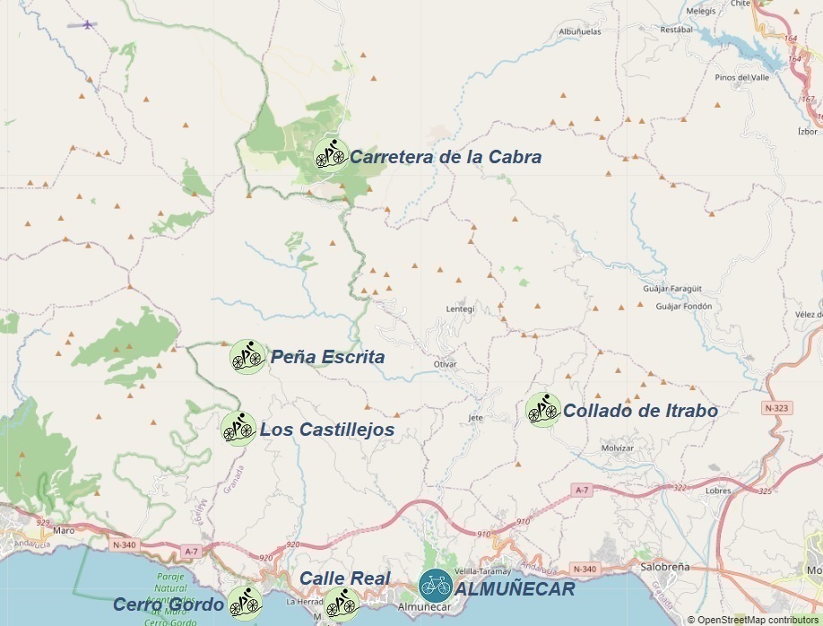
Hills accessible from Almuñecar:
1. 92km - Carretera de la Cabra: 1341m
- Collado de Itrabo: 505m
2. 34km - Peña Escrita: 1177m
3. 61km - Cerro Gordo: 200m
- Los Castillejos: 733m
- Camino Real: 151m


NERJA
The quickest way to get to the town of Nerja is by flying to Málaga-Costa del Sol Airport (AGP); information on arrivals at other airports and how to find a favorable flight combined with rail and bus transport can be found in the transport section;
One of the many options for affordable transportation to Nerja is:
After arriving at Málaga Airport (AGP), we head to the Alsa bus stop, where there is a direct bus to Nerja once a day at 2:30 PM. More information about transportation can be found here;
If we arrive in Malaga at a different time, we can take the A bus to the city center. The ticket costs 4€ and the bus stop is located tutaj; We get off at stop number 1905 - Estación de Autobuses;
At Estación de Autobuses, we transfer to the Alsa bus, which runs to Nerja approximately every 90 minutes. The journey takes between 45 minutes and 1 hour 30 minutes, and the ticket costs around 5€. The schedule with the option to download the app can be found on the movelia.es website;
Upon arrival in Nerja, we can either walk or take a taxi to the previously booked accommodation. Good places to search for accommodation are trusted websites such as airbnb.com and booking.com;
If you want to take advantage of the gastronomic offer, the locations of restaurants can be found on mapy.cz website;
If you are not hungry, don't waste time and head to the most important point of the program...
Cycle Nerja bike rental service delivers bikes to specified addresses in Nerja, Torrox, Frigiliana, La Herradura, Almunecar, Salobrena, and the surrounding area. It's worth reserving a bike well in advance to ensure availability upon arrival.
Current bike rental prices and the range of free bike delivery can be found on the rental company's website.
All proposed cycling routes (GPX tracks) from Nerja start at the Via Recanati parking lot or after arriving by train at the Novara-Montalbano-Furnari and Carruba stations.
If you arrive in Nerja by car, you must find a safe parking spot. Paid and free parking spots are shown on the mapy.cz website;
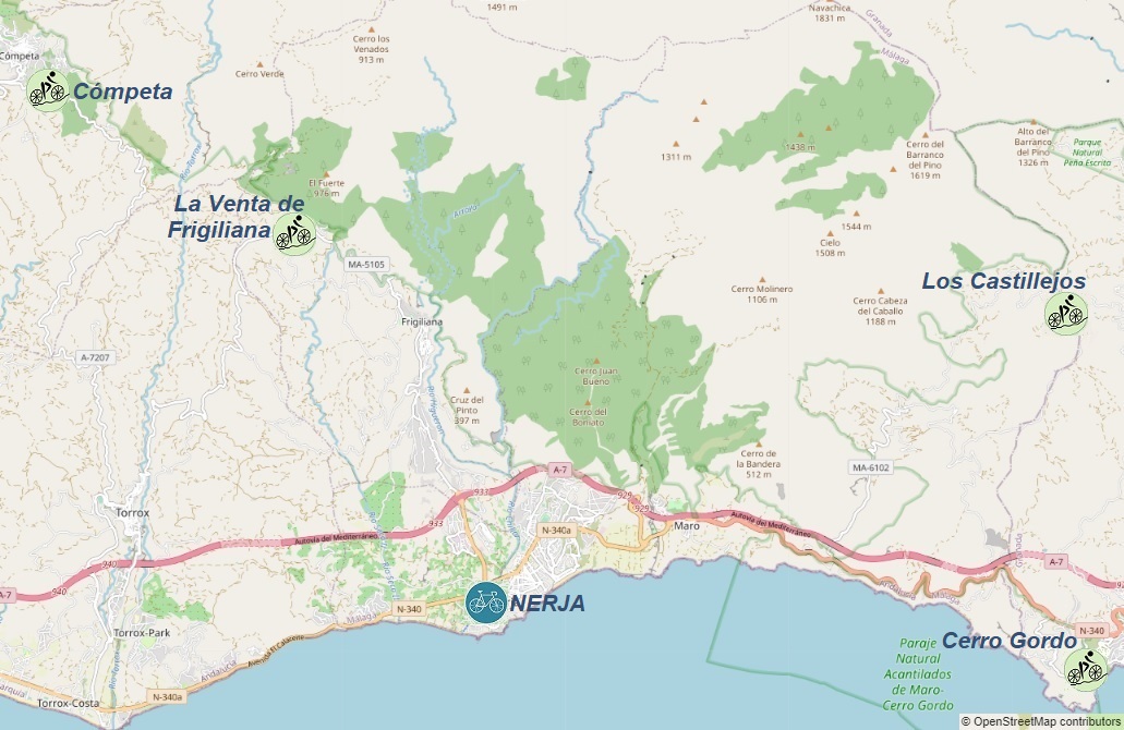
Hills accessible from Nerja:
1. 58km - La Venta de Frigiliana: 467m
- Cómpeta: 650m
2. 53km - Los Castillejos: 733m
- Cerro Gordo: 200m


TORRE DEL MAR
The quickest way to get to the town of Torre del Mar is by flying to Málaga-Costa del Sol Airport (AGP); information on arrivals at other airports and how to find a favorable flight combined with rail and bus transport can be found in the transport section;
One of the many options for affordable transportation to Torre del Mar is:
After arriving at Málaga-Costa del Sol Airport, we go to the C1 train station, where trains depart to the center of Malaga every few minutes. We get off at Málaga María Zambrano station and walk to the bus station - Estación de Autobuses, which is right next to it. More information about transportation from the airport can be found here;
At Estación de Autobuses we change to the Alsa bus, which runs to Torre del Mar every about 45 minutes; the journey takes from 45 minutes to 1 hour and the ticket costs around 3€; the timetable with the possibility of downloading the application can be found on the movelia.es website;
Upon arrival in Torre del Mar, we can either walk or take a taxi to the previously booked accommodation. Good places to search for accommodation are trusted websites such as airbnb.com and booking.com;
If you want to take advantage of the gastronomic offer, the locations of restaurants can be found on mapy.cz website;
If you are not hungry, don't waste time and head to the most important point of the program...
Cycle Torre del Mar road bike rental delivers bikes to designated addresses in Torre del Mar, Caleta de Velez, and the surrounding area; it's worth reserving a bike well in advance to ensure that a bike is available upon arrival; current bike rental prices and the range of free bike delivery can be found on the rental website.
All cycling route proposals (gpx traces) from Torre del Mar start at the Via Recanati parking lot or after arriving by train at the Novara-Montalbano-Furnari and Carruba stations.
If we arrived in Torre del Mar by car, we must find a safe parking spot; paid and free parking lots are shown on the mapy.cz website;
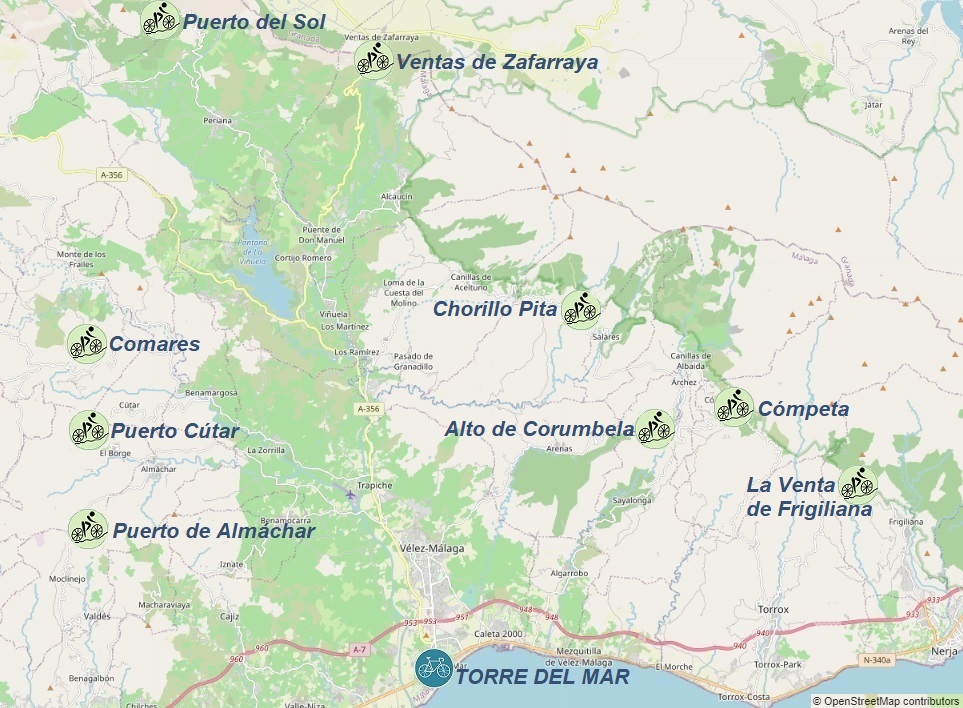
Hills accessible from Torre del Mar:
1. 99km - Puerto del Sol: 1080m
- Ventas de Zafarraya: 910m
2. 65km - Alto de Corumbela: 604m
- Chorillo Pita: 706m
3. 76km - Cómpeta: 650m
- La Venta de Frigiliana: 467m
4. 83km - Comares: 700m
- Puerto Cútar: 450m
- Puerto de Almáchar: 601m


MALAGA
To get to the town of Málaga most quickly, you can fly into Málaga-Costa del Sol Airport (AGP). Information on finding a convenient flight can be found in the transport section;
Upon arriving at Málaga-Costa del Sol Airport, head to the bus stop, where Interbus departs every 30 minutes towards Catania Via Archimede (Catania Centrale Station), with a travel time of 10 minutes. The ticket price is 3-5€, and the schedule can be found on the interbus.it website;
Transfer to a regional train and disembark at Alcantara;
Upon arrival in Málaga, you can use public transportation (the Giardini Naxos bus stop is located 100m south of the train station) or a taxi to reach your pre-booked accommodation. Good places to look for lodging are trusted services like airbnb.com and booking.com;
If you want to explore the local dining options, you can find the locations of dining establishments on the mapy.cz website;
If you're not hungry, don't waste any time and proceed to the main agenda...;
Cycle Málaga a road bike rental service, delivers bikes to specified addresses in the following towns and nearby areas: Alcaucin, Almayate, Almunecar, Archez, Arenas, Canillas de Aceituno, Competa, Corumbela, Canillas de Albaida, El Morche, Frigiliana, La Herradura, Malaga City, Marina del Este, Maro, Nerja, Periana, Puente don Manuel, Rio Gordo, Rincon de la Victoria, Salares, Salobrena, Sayalonga, Sedella, Torrox, Torre Del Mar, Velez-Malaga;
It's advisable to book a bike well in advance to ensure availability upon arrival. Current bike rental prices and the free bike delivery radius can be found on the rental company's website;
All cycling route suggestions (GPX tracks) starting from Málaga can begin at the Via Recanati parking lot or after arriving by train at the Novara-Montalbano-Furnari and Carruba stations;
If you're arriving in Málaga by car, you'll need to find a safe parking spot. Paid and free parking options are displayed on the
mapy.cz website;
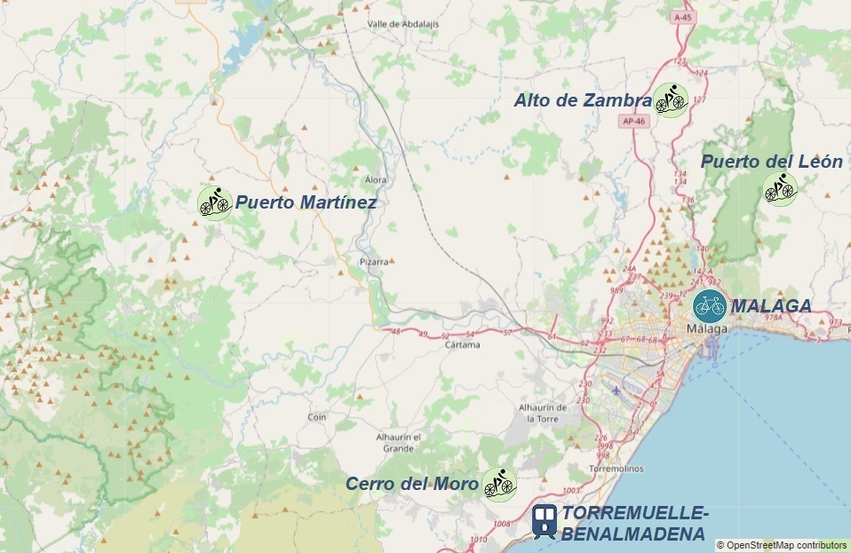
Hills accessible from Málaga:
1. 48km - Puerto del León: 938m
2. 84km - Puerto del León: 938m n.p.m.
- Alto de Zambra: 731m n.p.m.
3. 125km - Cerro del Moro: 953m n.p.m.
- Puerto Martínez: 704m n.p.m.


GRANADA
To reach the town of Granada most quickly, you can fly into Granada Airport (GRX). Information on finding a convenient flight can be found in the transport section;
Upon arriving at Granada Airport, head to the bus stop, where Interbus departs every 30 minutes towards Catania Via Archimede (Catania Centrale Station), with a travel time of 10 minutes. The ticket price is 3-5€, and the schedule can be found on the interbus.it website;
Transfer to a regional train and disembark at Alcantara;
Upon arrival in Granada, you can use public transportation (the Giardini Naxos bus stop is located 100m south of the train station) or a taxi to reach your pre-booked accommodation. Good places to look for lodging are trusted services like airbnb.com and booking.com;
If you want to explore the local dining options, you can find the locations of dining establishments on the mapy.cz website;
If you're not hungry, don't waste any time and proceed to the main agenda...
Bicicletas La Estacion a road bike rental service, is located at: Calle Molinos 20, 18009 Granada;
It's advisable to book a bike well in advance to ensure availability upon arrival. Current bike rental prices and the free bike delivery radius can be found on the rental company's website;
All cycling route suggestions (GPX tracks) starting from Granada begin at the train station.;
If you're arriving in Granada by car, you'll need to find a safe parking spot. Paid and free parking options are displayed on the mapy.cz website;
For more information about the town and its surroundings, you can visit official city website;
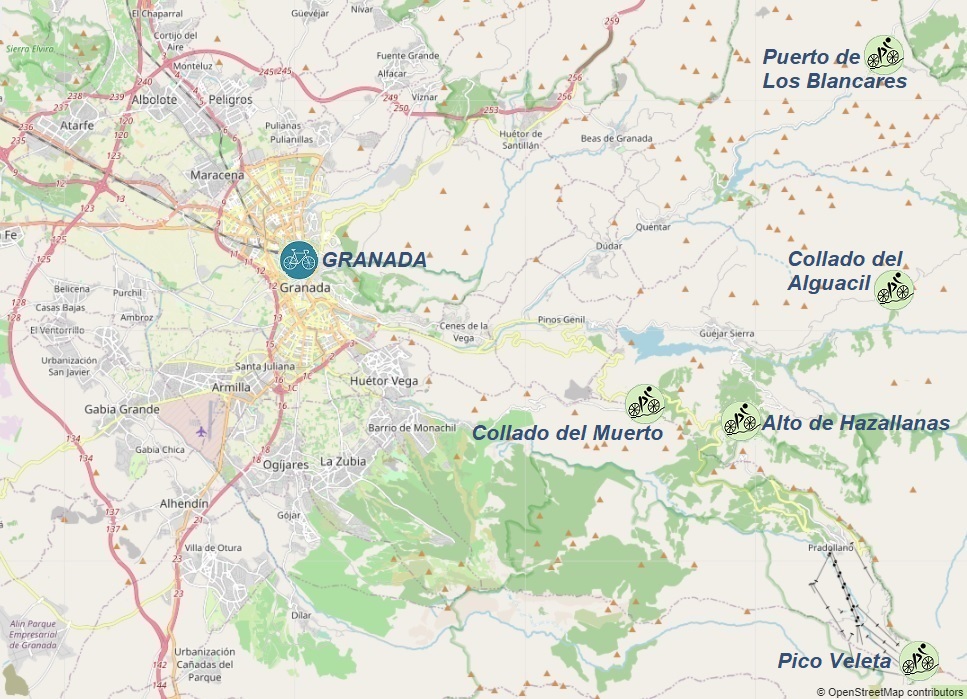
Hills accessible from Granada:
1. 96km - Pico Veleta: 3295m
2. 83km - Collado del Muerto: 1491m
- Puerto de Los Blancares: 1297m
3. 70km - Collado del Alguacil: 1898m
- Alto de Hazallanas: 1675m


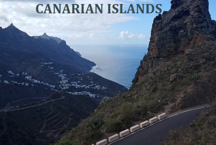
CANARIAN ISLANDS - Gran Canaria
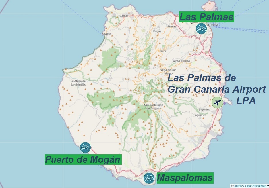
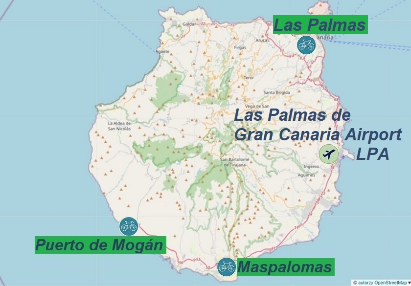
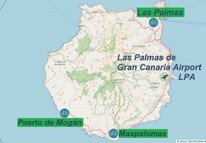
Maspalomas: Pico de las Nieves, Alto de Fataga...
Puerto de Mogan: Valley of the Tears, Ruta de las Presas...
Las Palmas: Alto de los Moriscos, Cruz de Tejeda...
MASPALOMAS
To get to the town of Maspalomas most quickly, you can arrive by plane at Las Palmas de Gran Canaria Airport (LPA); information about arrivals can be found in the transport section;
One of the many options for reaching Maspalomas affordably is as follows:
Upon arriving at Las Palmas de Gran Canaria Airport (LPA), head to the bus stop where buses to Maspalomas depart every few minutes. The bus schedule can be found here;
Renting a car is also a good solution - a well-established rental company is Cicar; When traveling with a group of two people, it's advisable to rent a car with a roof rack for two bicycles. Currently (as of October 2023), the rental company has a Peugeot 108 car with such a roof rack (sufficient for two people). With this car, you can easily go to any convenient starting point for your planned route.
Upon arriving in Maspalomas, we reach our previously reserved accommodation. Good places to search for accommodation are trusted websites: airbnb.com and booking.com;
If we wish to explore dining options, we can find the locations of restaurants and eateries on the mapy.cz website;
If we're not hungry, we don't waste time and proceed to the main point of our agenda...
Below are selected road bike rental options:
Rent Bike Playa Meloneras is located at: Ground Floor, Local 112, C.C. Playa, 35100 Maspalomas
Free Motion is located at: C.C Oasis Beach, Avenida Cristóbal Colón, s/n, 35100 Meloneras
Life On 2 Wheels Bike Center is located at: C/ Teowaldo Power s/n CC Sonnenland, Local S-112 ES-35100 Maspalomas
Cyclo Canaria is located at: C. Teowaldo Power, s/n, 35100 Maspalomas
It's advisable to reserve a bike well in advance to ensure bike availability upon arrival. Current bike rental prices and options for bike delivery to your accommodation or organizing island tours can be found on the rental shop websites;
All proposed cycling routes (GPX tracks) starting from the town of Maspalomas begin at the roundabout connecting Avenida de Tirajana and Av de la Union Europea (GC-500).
For more information about the town and its surroundings, you can find it here;
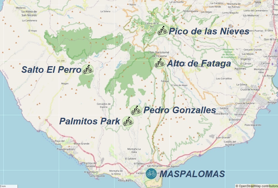
Hills accessible from Maspalomas:
1. 100km - Pico de las Nieves: 1936m
2. 43km - Palmitos Park: 404m
- Pedro Gonzalles 490m
3. 67km - Alto de Fataga: 939m
4. 77km - Salto El Perro: 926m


PUERTO DE MOGAN
To get to the town of Puerto de Mogán most quickly, you can arrive by plane at Las Palmas de Gran Canaria Airport (LPA); information about arrivals can be found in the transport section;
One of the many options for reaching Puerto de Mogán affordably is as follows:
Upon arriving at Las Palmas de Gran Canaria Airport (LPA), head to the bus stop where direct buses to Puerto de Mogán depart every hour. These buses belong to line 91. The bus schedule can be found here;
Renting a car is also a good solution - a well-established rental company is Cicar; When traveling with a group of two people, it's advisable to rent a car with a roof rack for two bicycles. Currently (as of October 2023), the rental company has a Peugeot 108 car with such a roof rack (sufficient for two people). With this car, you can go to any convenient starting point for your planned route.
Upon arriving in Puerto de Mogán, we reach our previously reserved accommodation. Good places to search for accommodation are trusted websites: airbnb.com and booking.com.
If we wish to explore dining options, we can find the locations of restaurants and eateries on the mapy.cz website;
If we're not hungry, we don't waste time and proceed to the main point of our agenda...
Road bike rental shop:
Free Motion is located at: los Marrero Hotel Cordial Playa, Avenida de Mogán, 35138 Puerto de Mogán
It's advisable to reserve a bike well in advance to ensure bike availability upon arrival. Current bike rental prices and options for bike delivery to your accommodation or organizing island tours can be found on the rental shop's website;
All proposed cycling routes (GPX tracks) starting from the town of Puerto de Mogán begin at the parking lot on Calle la Maleza;
For more information about the town and its surroundings, you can find it here;
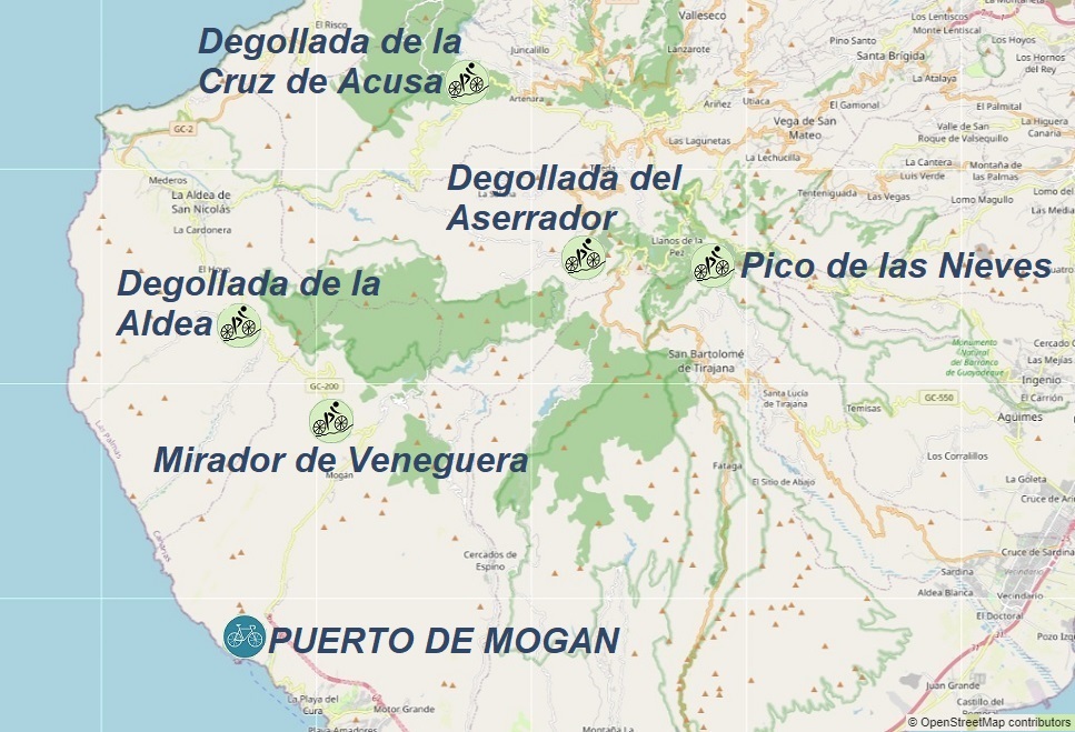
Hills accessible from Puerto de Mogán:
1. 91km - Pico de las Nieves: 1936m
2. 115km - Mirador de Veneguera: 432m
- Degollada de la Aldea 677m
- Degollada de la Cruz de Acusa: 1099m
- Degollada del Aserrador: 1406m


LAS PALMAS
To get to the town of Las Palmas most quickly, you can arrive by plane at Las Palmas de Gran Canaria Airport (LPA); information about arrivals can be found in the transport section;
One of the many options for reaching Las Palmas affordably is as follows:
Upon arriving at Las Palmas de Gran Canaria Airport (LPA), head to the bus stop, where direct buses to Las Palmas depart every 15 minutes. These buses belong to line 60. The bus schedule can be found here;
Renting a car is also a good solution. A well-established rental company is Cicar; When traveling with a group of two people, it's advisable to rent a car with a roof rack for two bicycles. Currently (as of October 2023), the rental company has a Peugeot 108 car with such a roof rack (sufficient for two people). With this car, you can go to any convenient starting point for your planned route;
Upon arriving in Las Palmas, we reach our previously reserved accommodation. Good places to search for accommodation are trusted websites: airbnb.com and booking.com;
If we wish to explore dining options, we can find the locations of restaurants and eateries on the mapy.cz website;
If we're not hungry, we don't waste time and proceed to the main point of our agenda...
Road bike rental shops:
Rental Bike Station Las Palmas 24 is located at: C. Veintinueve de Abril, 63, 35007 Las Palmas de Gran Canaria
Free Motion is located at: C. León y Castillo, 323, 35006 Las Palmas de Gran Canaria
It's advisable to reserve a bike well in advance to ensure bike availability upon arrival. Current bike rental prices and options for bike delivery to your accommodation or organizing island tours can be found on the rental shop websites;
All proposed cycling routes (GPX tracks) starting from the town of Las Palmas begin at Plaza España;
For more information about the town and its surroundings, you can find it here;
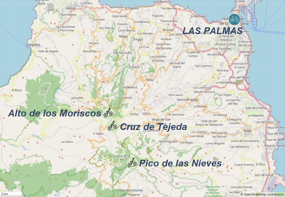
Hills accessible from Las Palmas:
1. 86km - Alto de los Moriscos: 1636m
2. 91km - Cruz de Tejeda: 1510m
- Pico de las Nieves 1936m

